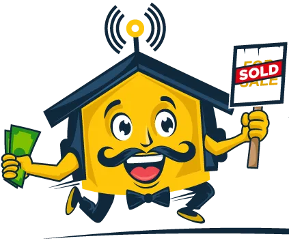
We Buy Houses
Need To Sell Your House Fast?
Need To Sell Your House Fast?
We buy houses in any condition or situation.
Skip the traditional market hassles and fees!
Get A Cash Offer In 3 Steps!
Submit Your Information
Kick off the process with a simple online form, available 24/7 for your convenience.
Get A Cash Offer
With our streamlined process, we can quickly determine your eligibility for a cash out sale.
Close & Get Paid
Finalize the home sale and receive your funds in a timely manner.
Real Testimonials From Happy Sellers

How do I get home cash offer?
We make selling your house simple and fast. To qualify, we look at a few things like your home’s condition and location. Our goal is to help homeowners who need quick cash or want to avoid the hassle of traditional selling. Ready to find out if you qualify? Contact us today!

Get a Fast Home Offer
We know life happens fast, and you need solutions quickly. That’s why we’ve made our process simple and speedy. After you contact us, we’ll verify your home details and give you a fast cash offer. No waiting, no stress—just a clear answer in hours. Ready to sell your house fast? Reach out today!
500+
Satisfied Home Sellers
14+
Years of Experiance
25+
Cities Covered
Many Reasons Sellers Prefer A Cash Sale
The Hassle of Repairs, Updates And Agent Fees Of A Traditional Listing Is Not For Everyone
Downsizing
Moving to a smaller home can save money and reduce stress. It helps you focus on what matters by getting rid of things you don’t need. Downsizing means less work and a home that fits your life better, making it easier to live comfortably and save money.
Divorce
Divorce can be hard, but selling your home can help you move on. A smaller home can make things easier. Selling lets you share the money fairly and avoid home repairs. It’s a quick way to start fresh.
Repairs
Selling a home with repairs needed can be hard. Instead of fixing things, you can sell your home to a cash buyer. We will buy it as-is, so you don’t have to worry about repairs.
It’s a fast and easy way to sell.
Job Relocation
If you're moving for a job, selling your home to a cash buyer is a fast and easy solution. You won't have to worry about repairs or waiting. A cash sale lets you move quickly and focus on your new job without the stress of selling your house.
Debt Payoff
If you need help with debt, selling your home to a cash buyer can give you fast cash. This lets you pay off your bills quickly without the stress of repairs or waiting. It’s a simple way to improve your financial situation.
Bad Rentals
Tired of tenants, toilets and costs? Being a landlord can be exhausting. If you're tired of managing your property, selling your rental home to a cash buyer is a fast way to move on. You won’t have to worry about repairs or waiting around. Selling for cash helps you sell quickly and easily.
How It Works
We determine a Cash Home Offer following this easy 3 Step Process.
Step 1: Property Condition
What will it take to get the property in showroom condition? Tell us about your home...
Your house might require minor or major fixes and updates.
We factor in these costs to ensure it's up to standard for new owners with our internal systems to determine a fast home offer.
We're Cash Home Buyers offering a convennient sale that's hassle-free, though at a lower price than retail showroom condition due to the risk and minimum profit required to stay in business.
The market and finishes required by retail buyers is constantly changing as well as lender requirements to finance the mortgages, you can skip all of that by simply requesting a free cash home offer over the phone.

Step 2: Market Research
How does the current market behave and what can be expected in any future sale? We will evaluate many factors to come up with the best offer for you and your timeline.
We base this on similar homes in your neighborhood that buyers find most appealing. These homes set the standard for the highest price your property could sell for once it’s fully updated and move-in ready.
To determine the value of your property after repairs, we calculate the costs needed to bring it to "showroom condition." This means the property would look like the best comparable home in your area that recently sold—a home that was likely updated from top to bottom with modern finishes, fresh paint, new flooring, and other improvements.

Step 3: Cash Offer Agreement
Do you want an easy hassle free sale or maximize sales price by making updates, repairs and listings? This is your choice but many rather cash out than dealing with all of these stresses.
If our cash home offer works for you and you are ok with us paying all of your closing costs and selling without investing more time, money and energy into the home simply review the agreement to start the process.
No printing, scanning, or mailing—just a few clicks on your phone or computer!

States We Buy Houses In Currently
Get A Home Cash Offer Without The Hassles Of A Traditional Sale
Texas
The Loan Star State
Texas is famous for its large size, diverse landscapes, and rich cultural history. Known for cowboy culture, BBQ, oil production, live music in Austin, and landmarks like The Alamo, Texas has a strong sense of independence and pride.
North Carolina
First In Flight State
Home to the Wright brothers' first flight in Kitty Hawk, North Carolina is known for its beautiful Blue Ridge Mountains, thriving Research Triangle, and a strong basketball culture tied to Duke and UNC.
Arizona
The Grand Canyon State
Arizona is renowned for the Grand Canyon, one of the Seven Natural Wonders of the World. It's also known for its desert landscapes, saguaro cacti, and vibrant Native American heritage.
It’s a fast and easy way to sell.
FAQS
How much will I get offered for my house?
It is not retail to maximize sales price you would need to update, repair and list which has costs involved. Our service is very much like trading in a car you get an easy as is sale for a below market sales price. Our process is completely transparent, and we want you to fully understand how we determine our offer. Our offer is based on several factors, including the potential value of your property after we make any needed upgrades and repairs. When you reach out to us and share some basic information about your property, we’ll guide you through our process and explain exactly how we come up with an offer that we believe is fair for both sides.
What timelines are you able to work with?
We will work with your timeline usually sellers want to sell within 30 to 90 days and we can definitely discuss what is most convenient such as a seller leaseback.
What does "All Cash" mean?
We transact through a title company and there will be no funny business. We use non traditionl funding sources such as private capital partnerships lenders and lines of credit. Since we are buying your home directly, there’s no need for traditional bank financing. This means there is virtually no risk of the deal falling through or delays at closing because of banking issues. When we make an offer to you, the amount we offer is the full cash amount you'll receive minus taxes or liens. There are no hidden fees, no commissions, and no closing costs – just the full offer amount.

Copyright 2026 . All rights reserved.
Powered by REiMachines.io
Copyright 2026 . All rights reserved.
Powered by REiMachines.io
Facebook
Instagram
X
Youtube